
Hiking Trails Near Seattle Under 1 Hour From the City: a Certified Local’s Guide
Six hiking trails near Seattle sit within about an hour’s drive of the city. Each entry lists drive time, distance, elevation gain, and which pass you need, if any.
In this article
From Cougar Mountain’s old-growth loop (roughly 25 minutes) to Franklin Falls near Snoqualmie Pass (roughly 55 minutes). This is hiking trails near Seattle helps you complete the round of hikes despite limited weekend time available.
By mid-October the bigleaf maples in the Cascade foothills turn butter yellow while the cedars and firs stay green, so the trails look patchworked rather than postcard-red. They are also quieter than in July, and a 3.5-mile hike with a 700-foot climb feels a lot better at 55 degrees than at 85.
This hiking trails list is ranked by drive time starting in Seattle, so you can match the trail to how much of your Saturday you want to spend in the car. Every trailhead is off I-90 or close to it. The pass question is where visitors get tripped up: three hikes need nothing, two need Washington’s Discover Pass, and one needs a federal pass the Discover Pass doesn’t cover.
| Hike | Drive from Seattle | Round trip | Elevation gain | Pass |
|---|---|---|---|---|
| Cougar Mountain (Wilderness Peak Loop) | ~25 min | 3.9 mi | ~1,200 ft | None |
| Poo Poo Point (Chirico Trail) | ~30 min | 3.8 mi | 1,760 ft | None at the lot |
| Rattlesnake Ledge | ~40 min | 4.0 mi | 1,160 ft | None listed |
| Little Si | ~40 min | 3.7 mi | 1,300 ft | Discover Pass |
| Twin Falls | ~45 min | 3.5 mi | 700 ft | Discover Pass |
| Franklin Falls | ~55 min | ~2 mi | Gentle | Forest Service pass |
Drive times are approximate, off-peak, from downtown Seattle. I-90 traffic on a fall weekend can add 15–20 minutes.
The Trails
Cougar Mountain Wilderness Peak Loop: the hiking trail nearest Seattle
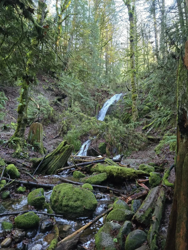
The closest real hike on this list is a 3.9-mile lollipop loop through some of the biggest, oldest trees on Cougar Mountain, plus mature second-growth stands of ferns, mossy maples and cedars. There are no views, which is the trade: the forest is the destination, and in the rain it stays walkable.
Cougar Mountain is a King County park, not state land, so there is no Discover Pass. The park covers 3,115 acres with 38 miles of trails, which makes it the best place on this list to build your own longer loop.
- Drive: ~25 min. Take I-90 to Exit 15, then SR 900 south for about 3.2 miles to the Wilderness trailhead.
- Distance: 3.9 miles, ~1,200 ft gain
- Pass: None
Caveat: Car break-ins are reported at this trailhead, so take valuables with you.
Trivia: Anti-aircraft guns stood on Cougar Mountain’s Anti-Aircraft Peak during World War II, and Cold War Nike missiles were installed nearby to defend against Soviet bombers. Only concrete pads, a chain-link fence and an interpretive sign remain.
Poo Poo Point via the Chirico Trail
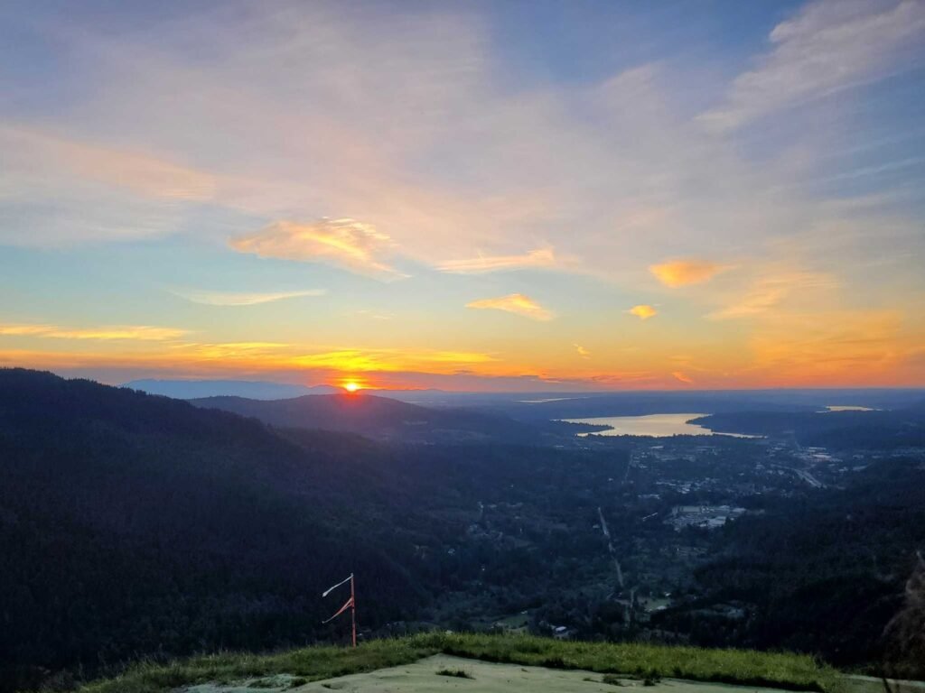
The name gets a laugh, but the trail is serious: 3.8 miles round trip with 1,760 feet of climbing, mostly on stone steps. Poo Poo Point sits 1.9 miles from the trailhead, and the South Launch Viewpoint about 1.6 miles in.
Time it for a clear afternoon and you may see paragliders step off the northwest face and drift out over the trees. Many land in the field beside the trailhead lot, so look up before you cross it.
- Drive: ~30 min. Take I-90 Exit 17 (Front Street) in Issaquah and head south. The gravel lot is on Issaquah Hobart Road, 3.1 miles from the freeway.
- Distance: 3.8 miles, 1,760 ft gain
- Pass: None at the lot, which is on King County land
Caveat: Portable toilets only, and no water. Steep sections wear on knees going down.
Rattlesnake Ledge
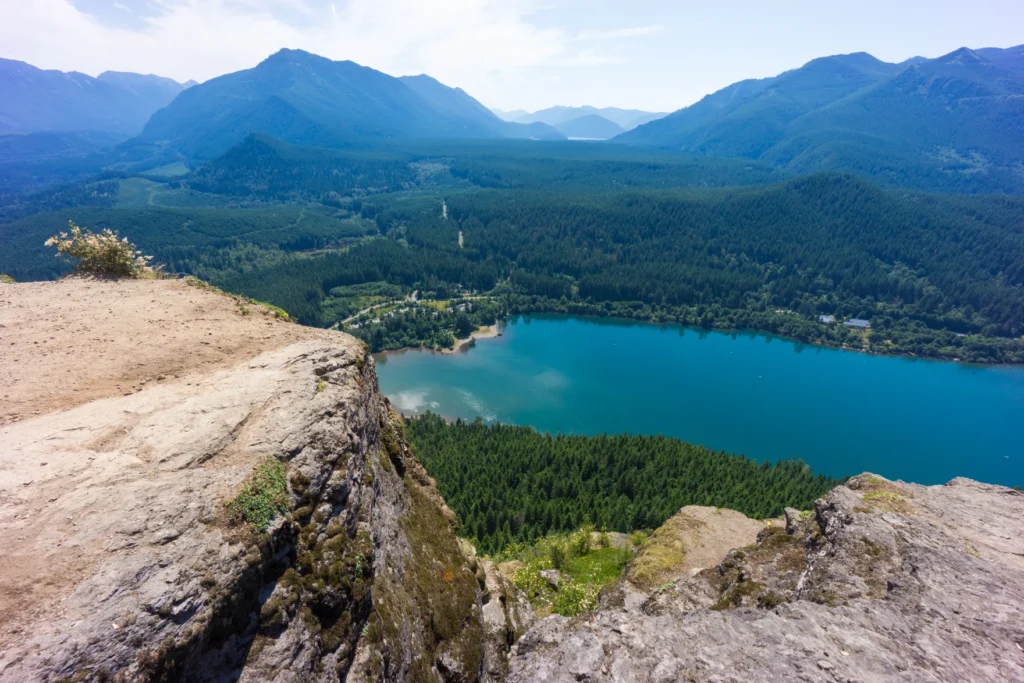
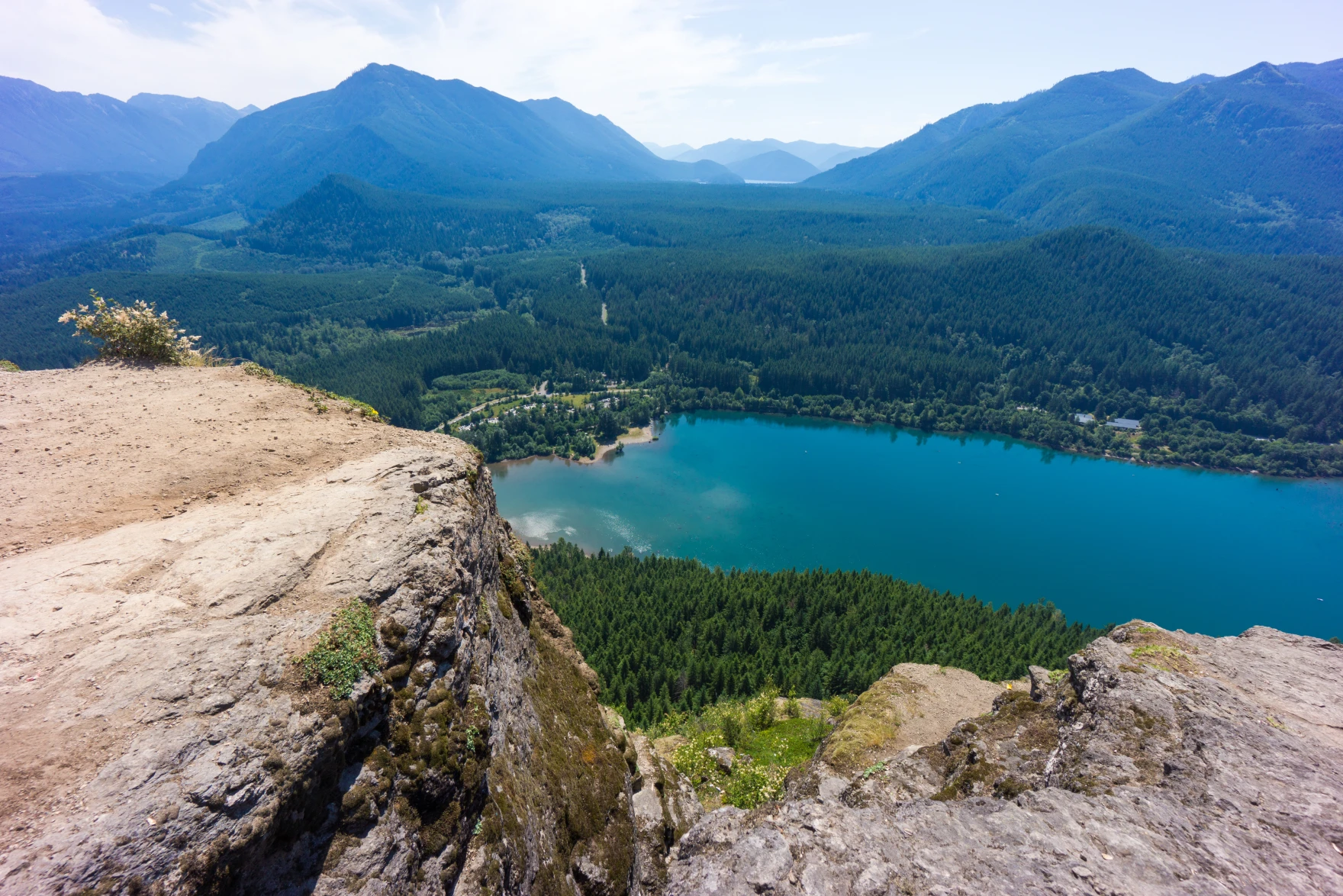
The most popular hike near Seattle for a reason: 4.0 miles round trip and 1,160 feet of climbing to a rocky ledge over Rattlesnake Lake. The land belongs to the City of Seattle, which manages the Cedar River Watershed, and WTA lists no parking pass.
It is well maintained and busy. Go on a weekday or early on a weekend morning, or plan on company at the top.
- Drive: ~40 min. Take I-90 Exit 32 (436th Ave SE, also signed Cedar Falls Road SE) and follow it about four miles to the lot on your right.
- Distance: 4.0 miles, 1,160 ft gain
- Pass: None listed
Local Tip: Skip the crowd at the main ledge. The middle and upper ledges are usually much quieter, per WTA.
Caveat: Some GPS apps still route to 208th Ave SE in Hobart, a road that now dead-ends about seven miles short of the trailhead. Navigate to the Rattlesnake Lake lot off 436th instead.
Little Si
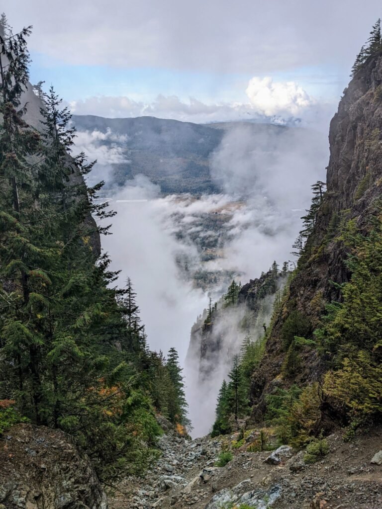
The shorter sibling to Mount Si: 3.7 miles round trip with 1,300 feet of gain, with similar views over North Bend and the valley. Several short side paths lead to rock climbing areas, so expect to share the trail with climbers carrying ropes.
Little Si is on Washington Department of Natural Resources land, so a Discover Pass is required for parking. WTA warns that both lots may be full on weekends.
- Drive: ~40 min. The main lot is on SE Mount Si Road, about 0.4 miles past the bend. An overflow lot lies just west.
- Distance: 3.7 miles, 1,300 ft gain
- Pass: Discover Pass
Caveat: If you reach the 439th or 440th Place SE turnoffs, you have passed the lot.
Twin Falls
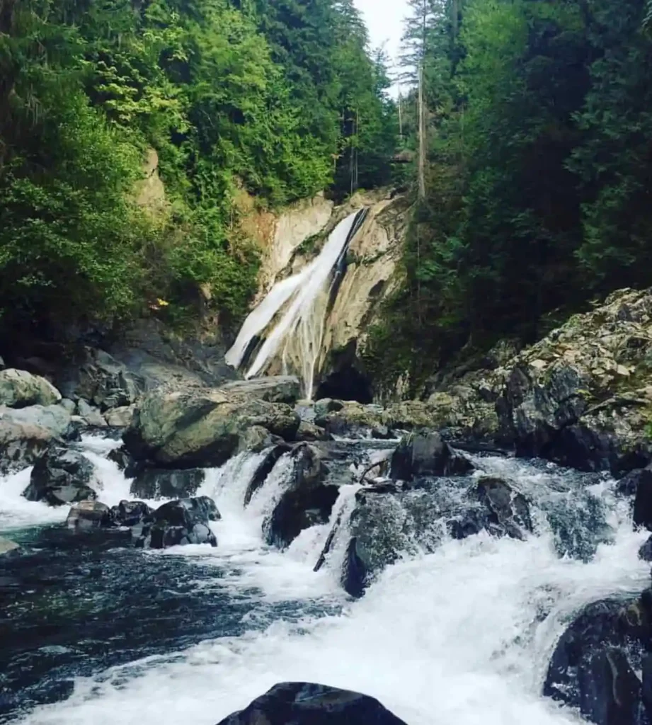
The best payoff for the least climbing on this list: 3.5 miles round trip with just 700 feet of gain. The trail starts under moss-draped maples and follows the South Fork Snoqualmie River up to the falls.
Leaf timing varies by year, but the maples along this trail are typically at their best from mid- to late October. The trailhead is in Olallie State Park, so a Discover Pass applies.
- Drive: ~45 min. Take I-90 Exit 34, turn right on SE Edgewick Road (468th Ave SE), then left on SE 159th Street to the road end.
- Distance: 3.5 miles, 700 ft gain
- Pass: Discover Pass
Caveat: Dogs must be leashed.
Highlight: The Discover Pass is $45 for a year or $10 for a day, since an October 1, 2025 price increase. Parking without one risks a $99 citation, so buy it before you drive out. Cougar Mountain, Poo Poo Point and Rattlesnake Ledge skip it entirely.
Franklin Falls
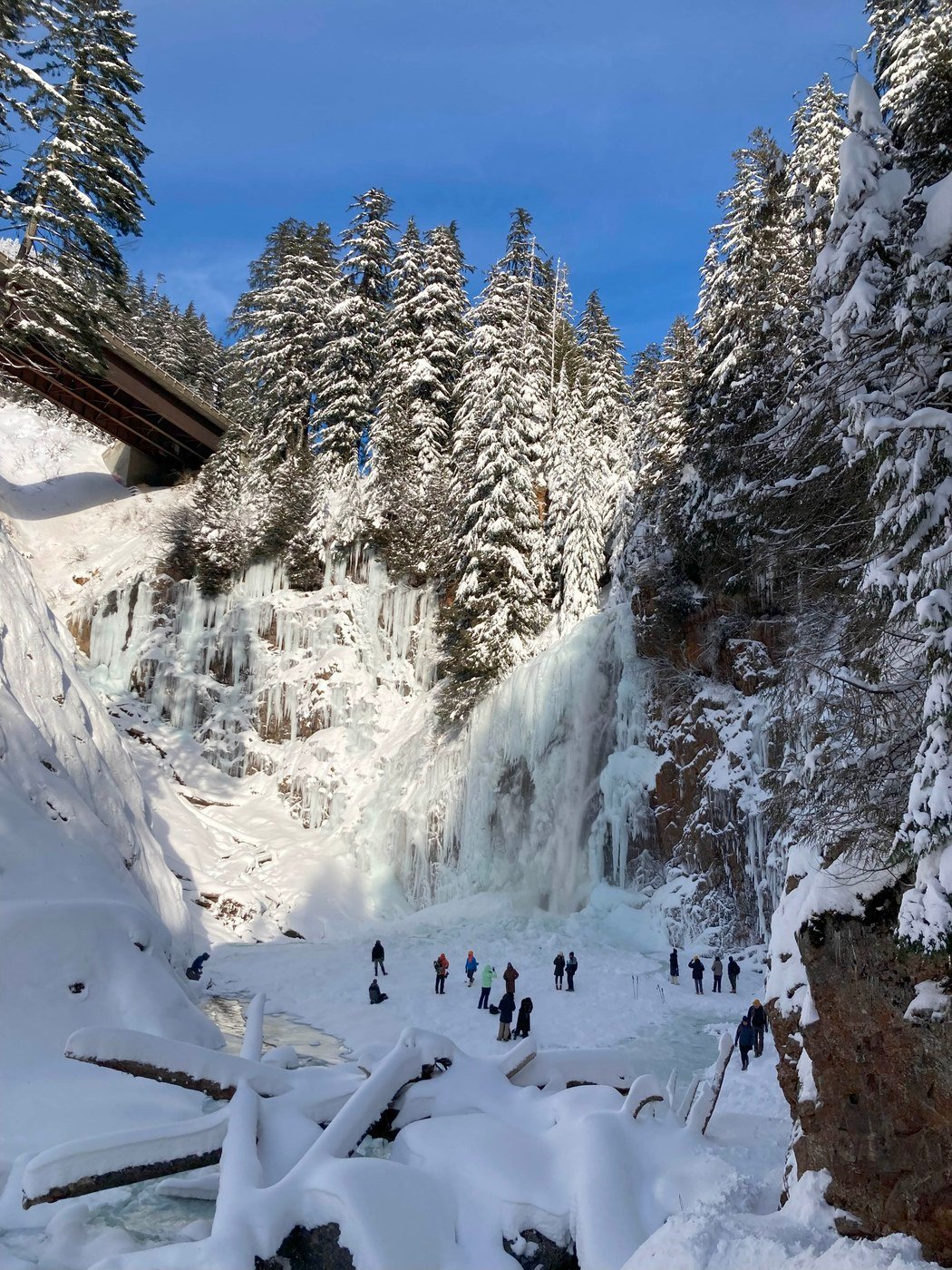
The farthest drive here is also the easiest walk: about 2 miles round trip to a tall waterfall near Snoqualmie Pass. It suits kids, grandparents and anyone who wants a big payoff without a big climb.
Franklin Falls is on national forest land, so the Discover Pass does not work here. The Forest Service takes a $5 day pass or a $30 annual pass per vehicle, and accepts the Northwest Forest Pass and Interagency passes. Pay at the fee machine, via Scan & Pay, or ahead of time in the recreation.gov app.
- Drive: ~55 min. Take I-90 east toward Snoqualmie Pass.
- Distance: about 2 miles round trip
- Pass: $5 per day or $30 per year, federal pass (Discover Pass not valid)
Caveat: Day use only. In winter the access road is not plowed and the Sno-Park will not operate, so reaching the falls becomes a much longer winter trek. Check Forest Service and WSDOT conditions before you go, and do not enter the Franklin Falls basin in avalanche season.
Getting There and Getting Around
All six are easiest by car, via I-90. Leave by 8 a.m. on a fall weekend to get a parking spot at Rattlesnake Ledge, Little Si and Twin Falls. Save directions offline before you leave, since WTA warns that app directions and cell service can be unreliable on some of these drives.
Frequently Asked Questions
Which of these hikes need a Discover Pass?
Little Si and Twin Falls. Cougar Mountain, Poo Poo Point and Rattlesnake Ledge need no pass. Franklin Falls needs a federal recreation pass instead.
Which hike is best for beginners or kids?
Franklin Falls (about 2 miles, gentle) and Twin Falls (3.5 miles, 700 feet of gain).
Which has the best fall color?
Twin Falls, where moss-draped maples line the early trail. Peak timing shifts year to year, so check recent trip reports.
What if it rains?
Cougar Mountain’s forest loop stays walkable in light rain. On a bad day, our indoor ideas for adults have you covered.
How crowded do these get?
Rattlesnake Ledge and Little Si are the busiest, and Little Si’s two lots may both fill on weekends. Cougar Mountain’s long trail network spreads people out.
Conclusion
For a first fall hike, start with Cougar Mountain or Twin Falls and save Franklin Falls for a day with kids. Afterward, warm up with hot apple cider in Seattle, or see what else belongs on your list in Only in October: What You Should Not Miss in Seattle.
References
- Poo Poo Point (Chirico Trail), Washington Trails Association: https://www.wta.org/go-hiking/hikes/poo-poo-point-chirico-trail
- Rattlesnake Ledge, Washington Trails Association: https://wta.org/go-hiking/hikes/rattlesnake-ledge
- Little Si, Washington Trails Association: https://www.wta.org/go-hiking/hikes/little-si
- Twin Falls, Hike of the Week: https://www.hikeoftheweek.com/?p=886
- Cougar Mountain Wilderness Peak Loop, Hike of the Week: https://www.hikeoftheweek.com/2021/04/15/cougar-mountain-wilderness-peak-loop/
- Cougar Mountain Regional Wildland Park, Wikipedia: https://en.wikipedia.org/wiki/Cougar_Mountain_Regional_Wildland_Park
- Franklin Falls Trailhead, US Forest Service: https://www.fs.usda.gov/r06/mbs/recreation/franklin-falls-trailhead
- Discover Pass program: https://discoverpass.wa.gov
- “Seattle Hikes,” 10Adventures: https://www.10adventures.com/hikes/seattle/